
|
|
| ČESKÁ REPUBLIKA | CZECH REPUBLIC |
| Jihočeský kraj | South Bohemia (České Budějovice) region |
| Okres: Tábor |
map →
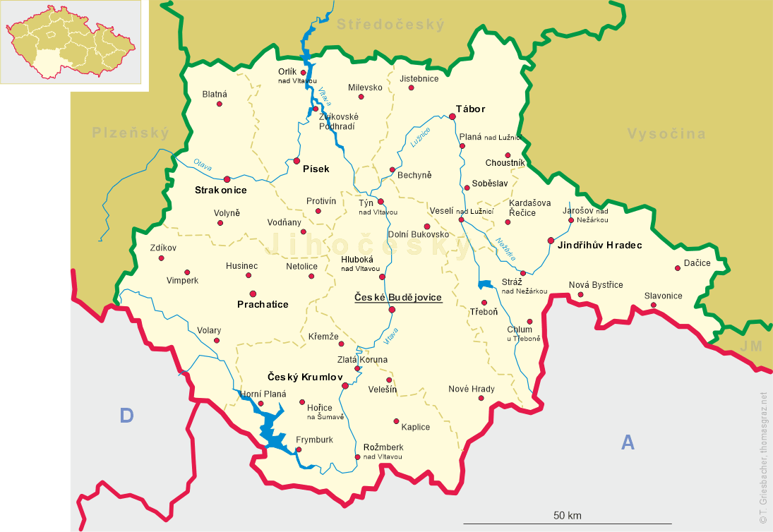
 Jistebnice is situated at an elevation of 578 m south of the Jistebnická vrchovina nature park, about 13 km northwest of
the district town, Tábor, about 58 km north of the regional capital, Ceské Budejovice,
and 67 km south of Prague. North of Jistebnice is the Jistebnická vrchovina nature park, which also includes
Javorová skála, the highest point 723 m) in the Tábor region. The municipality has a population of about 2,000 (2021).
Jistebnice is situated at an elevation of 578 m south of the Jistebnická vrchovina nature park, about 13 km northwest of
the district town, Tábor, about 58 km north of the regional capital, Ceské Budejovice,
and 67 km south of Prague. North of Jistebnice is the Jistebnická vrchovina nature park, which also includes
Javorová skála, the highest point 723 m) in the Tábor region. The municipality has a population of about 2,000 (2021).
The first mention of Stybnitz is found in historical sources from 1262. Jistebnice became a town for the first time before 1654. It lost this status after 1945 but became a town again in 2011.
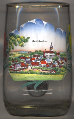
The  church of the Archangel Michael [background centre] was built in Gothic style in the
14th century in place of an earlier, Romanesque, church.
church of the Archangel Michael [background centre] was built in Gothic style in the
14th century in place of an earlier, Romanesque, church.
[https://en.wikipedia.org/wiki/Jistebnice, https://cs.wikipedia.org/wiki/Jistebnice]
![[scale]](lineal.jpg)