
|
|
| ČESKÁ REPUBLIKA | CZECH REPUBLIC |
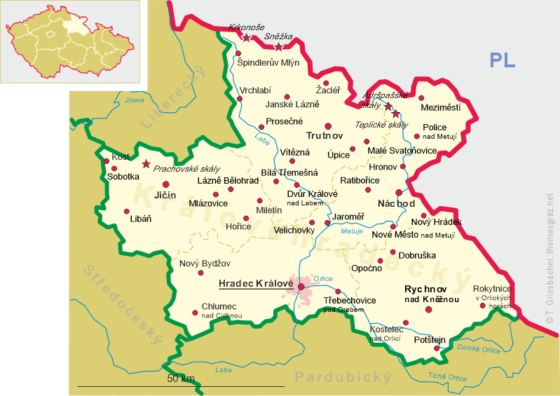
| Královéhradecký kraj | Hradec Králové region |
| Okres: Trutnov |
map →
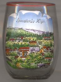 Špindlerův Mlýn (in German: Spindlermühle) is situated at an elevation of 718 m at the confluence of the river
Labe (Elbe) and the stream Svatopetrský potok (Grundwasser) in the Krkonoše (Giant Mountains) region of northern Bohemia, about 28 km
northwest of the district town Trutnov and about 60 northnorthwest of the regional capital Hradec
Králové. The municipality has a population of about 1,100 (2021). The municipality includes the localities Přední
Labská (Ochsengraben), Labská (Krausebauden), Bedřichov (Friedrichsthal) and Svatý Petr (Sankt Peter).
Špindlerův Mlýn (in German: Spindlermühle) is situated at an elevation of 718 m at the confluence of the river
Labe (Elbe) and the stream Svatopetrský potok (Grundwasser) in the Krkonoše (Giant Mountains) region of northern Bohemia, about 28 km
northwest of the district town Trutnov and about 60 northnorthwest of the regional capital Hradec
Králové. The municipality has a population of about 1,100 (2021). The municipality includes the localities Přední
Labská (Ochsengraben), Labská (Krausebauden), Bedřichov (Friedrichsthal) and Svatý Petr (Sankt Peter).
The eaerliest known written mentions of this place date from the early 16th century. The oldest, more densely populated part of the municipality
Svatý Petr, where silver and copper had been mined since 1516. Bedřichov owes its existence to a glassworks built in 1746.
Špindlerův Mlýn itself emerged in the late 18th century and was founded by forest workers who had immigrated from Silesia.
The parish was established in 1793 and consequently a new church was built in Svatý Petr. Ore mining in Svatý Petr was restricted in the
18th century. Tourism has been developing as an increasingly important economic factor since the middle of the 19th century, with
Spindlermühle forming a municipality in the judicial district (district as of 1850) of Hohenelbe (Vrchlabí).
From 1939 to 1945 Spindelmühle belonged to the Reichsgau Sudetenland (see map of the Germany in 1939). After the end
of the World War II, the majority of the German-speaking population of the town was expelled in 1945/1946.
[https://de.wikipedia.org/wiki/%C5%A0pindler%C5%AFv_Ml%C3%BDn]
![[scale]](lineal.jpg)