
|
|
| SLOVENSKO | SLOVAKIA |
| Prešovský kraj | Prešov region |
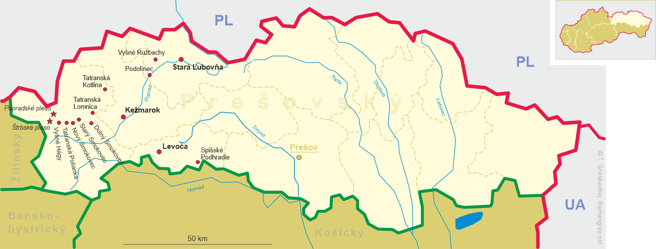
| okres: Poprad |
map →
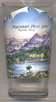 Popradské pleso is a mountain lake of glacial origin located in the High Tatras. It is situated right on the Tatranská
magistrála hiking path, at an altitude of 1,494 metres (the labelling on the glass, however, gives the elevation as 1,513 m), about 4 km
northeast of Štrbské pleso, part of the municipality Vysoké Tatry. Popradské pleso is one of the most visited spots in High Tatras and a starting point for many popular hikes including to Rysy and
Kôprovský štít. Near to the lake there is Symbolic Cemetery, built in a memory of the victims of the High Tatras.
Popradské pleso is a mountain lake of glacial origin located in the High Tatras. It is situated right on the Tatranská
magistrála hiking path, at an altitude of 1,494 metres (the labelling on the glass, however, gives the elevation as 1,513 m), about 4 km
northeast of Štrbské pleso, part of the municipality Vysoké Tatry. Popradské pleso is one of the most visited spots in High Tatras and a starting point for many popular hikes including to Rysy and
Kôprovský štít. Near to the lake there is Symbolic Cemetery, built in a memory of the victims of the High Tatras.
The name Popradské pleso is not derived from the name of the district town Poprad, but refers to the fact that the Krupá creek,
which drains the lake, is a headwater of the Poprad river. The name Poppersee was already mentioned in a document dating from 1644. In the
18th century (1736) the lake was named Rybie pleso (literally 'fish lake') due to the fact that fish lived only in this lake south of the main
Tatra ridge; to distinguish it from a homonymous lake in the Polish part of the Tatra mountains (today named Morskié oko), it was also called
Malé Rybie pleso ('small fish lake'). In the 19th century, people also spoke of Mengusovské pleso (German: Mengsdorfer See)
because it belonged to the municipality of Mengusovce at the time. Ultimately, however, the name Popradské pleso prevailed.
[https://en.wikipedia.org/wiki/Popradsk%C3%A9_pleso, https://de.wikipedia.org/wiki/Popradsk%C3%A9_pleso]
![[scale]](lineal.jpg)