
|
|
| ÖSTERREICH | AUSTRIA |
| Bundesland: Niederösterreich | Lower Austria |
| Bezirk: Amstetten |
map →

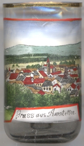
 Archeological finds demonstrate that the area of Amstetten was already
inhabited in prehistoric times. Amstetten was first mentioned in a document of
1111 as a market belonging to the archdiocese of Passau. The nearby village of
Ulmerfeld had already been mentioned in 995 as a market belonging to the
diocese of Freising. As the two markets grew during the 13th century, King
Rudolph I granted them the privilege of fortifying the villages in 1276; however,
only Ulmerfeld set up extensive fortifications. With the opening of the railway
line from Vienna to the West of the country (Kaiserin-Elisabeth-Westbahn) in 1858
and the opening of another line from Amstetten to the south to Styria
(Kronprinz-Rudolph-Bahn) in 1872, Amstetten became an important traffic junction.
Amstetten became the seat of the district administration in 1868 and obtained
the freedom of the city in 1897 by privilege of Emperor Franz Joseph I.
In 1972, Amstetten was merged with the neighbouring communes of Preinsbach,
Mauer and Ulmerfeld-Hausmening.
Archeological finds demonstrate that the area of Amstetten was already
inhabited in prehistoric times. Amstetten was first mentioned in a document of
1111 as a market belonging to the archdiocese of Passau. The nearby village of
Ulmerfeld had already been mentioned in 995 as a market belonging to the
diocese of Freising. As the two markets grew during the 13th century, King
Rudolph I granted them the privilege of fortifying the villages in 1276; however,
only Ulmerfeld set up extensive fortifications. With the opening of the railway
line from Vienna to the West of the country (Kaiserin-Elisabeth-Westbahn) in 1858
and the opening of another line from Amstetten to the south to Styria
(Kronprinz-Rudolph-Bahn) in 1872, Amstetten became an important traffic junction.
Amstetten became the seat of the district administration in 1868 and obtained
the freedom of the city in 1897 by privilege of Emperor Franz Joseph I.
In 1972, Amstetten was merged with the neighbouring communes of Preinsbach,
Mauer and Ulmerfeld-Hausmening.
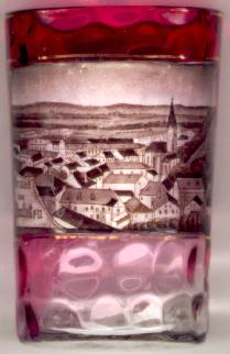
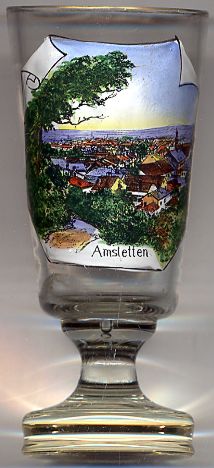
The  parish church Sankt Stephan [near left, no. 422: right]
was built in the 13th century originally as a Romanesque basilica with a
west tower. During the 14th century a Gothic vaulting was added.
parish church Sankt Stephan [near left, no. 422: right]
was built in the 13th century originally as a Romanesque basilica with a
west tower. During the 14th century a Gothic vaulting was added.
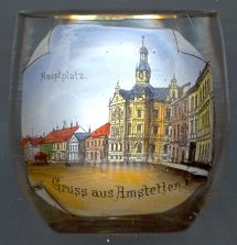
The picture on glass no. 1618 [near left] shows the
Hauptplatz town hall
![[scale]](lineal.jpg)