
|
|
| ÖSTERREICH | AUSTRIA |
| Bundesland: Oberösterreich | Upper Austria |
| Bezirk: Gmunden |
map →
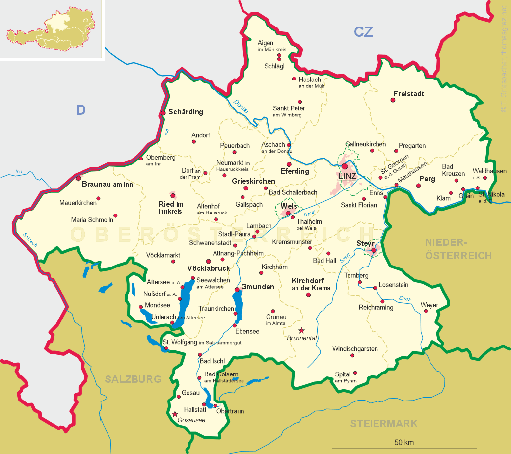
 Obertraun is situated at an elevation of 511 m at the mouth of
the river Traun (Koppentraun) into the lake Hallstättersee (see Hallstatt).
It is a popular resort for summer and winter tourism.
Obertraun is situated at an elevation of 511 m at the mouth of
the river Traun (Koppentraun) into the lake Hallstättersee (see Hallstatt).
It is a popular resort for summer and winter tourism.
A cable-railway takes tourists from Obertraun to the Schönbergalm at an
elevation of 1338 m on the on the northern edge of the Dachstein massif
with the entrance to the Dachstein caves.
The Rieseneishöhle (giant ice cave) has a length of 2000 m and is famous
for its fabulous ice formations (electrical light since 1928). The Mammuthöhle
(mammoth cave) has a total length of 48 km and a depth of 1180 m.
It is one of the largest stalactite caverns of Europe. The caves were explored
scientifically for the first time in 1909/10 and were then made accessible for tourists.
Since 1928 they have the status of a natural monument.
![[scale]](lineal.jpg)