
|
|
| ČESKÁ REPUBLIKA | CZECH REPUBLIC |
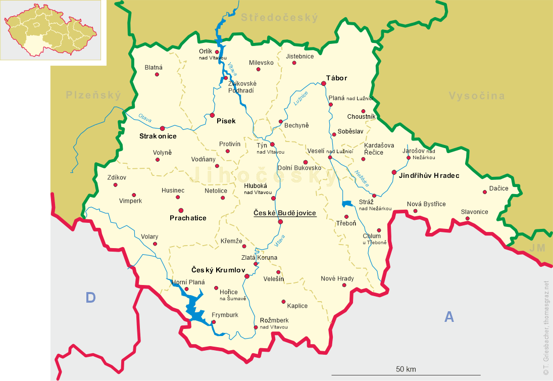
| Jihočeský kraj | South Bohemia (České Budějovice) region |
| Okres: Prachatice |
map →
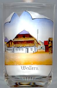 Volary is situated in a broad bassin surrounded by the Šumava (Böhmerwald) mountains. During the 14th century
it became a resting place on the 'Golden Path', the trading route from Passau to Prachatice.
The name of the town, 'Wallern', was first mentioned in a document of 1359. A typical feature of the village always had been
the architecture of its houses which were erected in a typical alpine style so that
it has been speculated that the earliest settlers had come from the Alps. However, the construction of these houses which consisted
at least in part of wood, was also the cause of frequent large fires. Since the last fire in 1863 only a few of these typical houses are left.
Volary received the status of a free town in 1871.
Volary is situated in a broad bassin surrounded by the Šumava (Böhmerwald) mountains. During the 14th century
it became a resting place on the 'Golden Path', the trading route from Passau to Prachatice.
The name of the town, 'Wallern', was first mentioned in a document of 1359. A typical feature of the village always had been
the architecture of its houses which were erected in a typical alpine style so that
it has been speculated that the earliest settlers had come from the Alps. However, the construction of these houses which consisted
at least in part of wood, was also the cause of frequent large fires. Since the last fire in 1863 only a few of these typical houses are left.
Volary received the status of a free town in 1871.
Ninety-five young girls and women, victims of a Nazi death march, are buried on the cemetery of Volary. Another 118 Jewish girls
were liberated by the U.S. Army here on 5 May 1945. Also, the last official casualty of World War II occurred here: a Czech-American soldier
was killed on 7 May 1945, just 10 minutes before the cease-fire orders became effective.
![[scale]](lineal.jpg)