
|
|
| DEUTSCHLAND | GERMANY |
| Bundesland: Niedersachsen | Lower Saxony |
| Landkreis: Stade |
map →
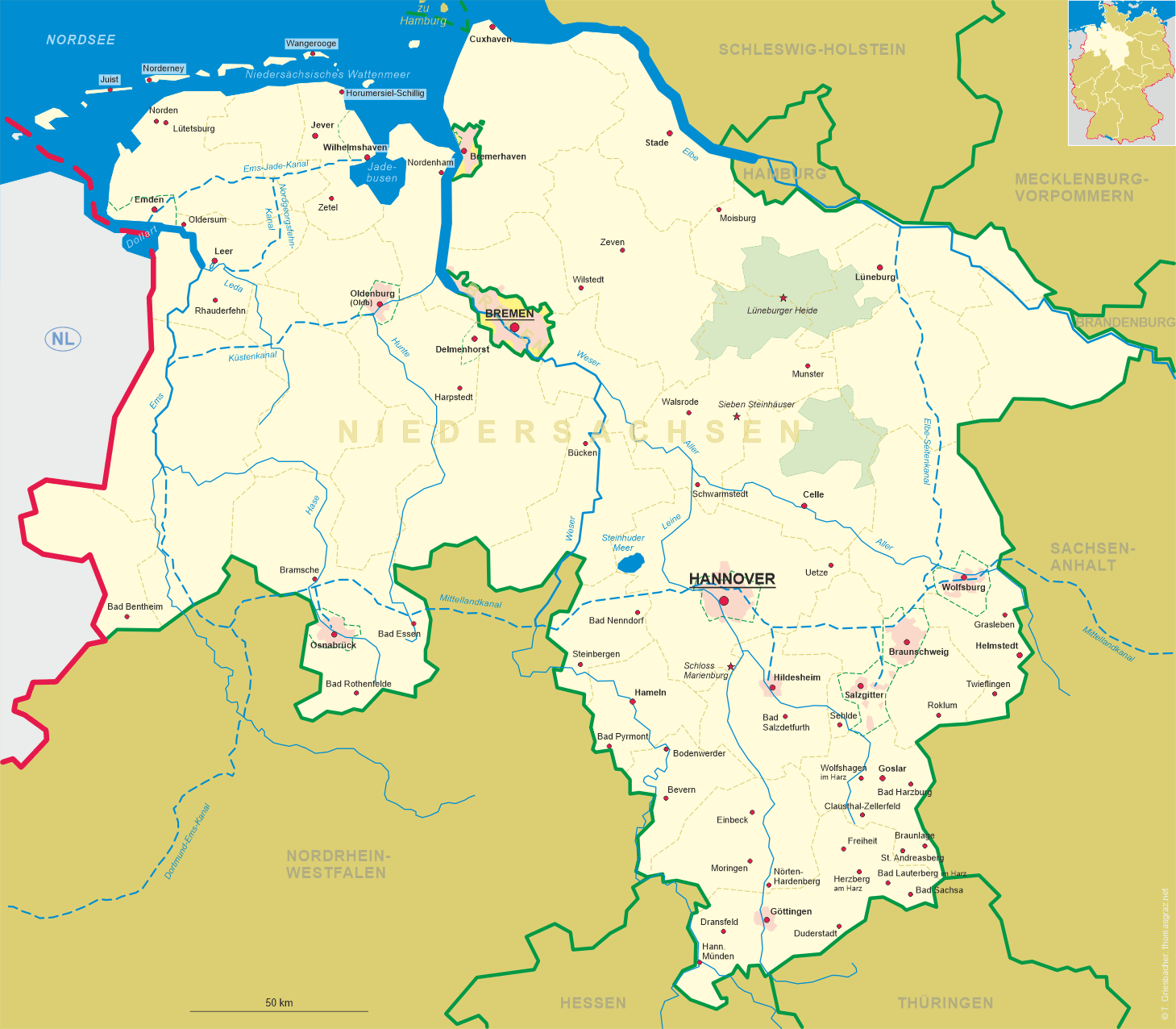
 Stade is situated on the river Schwinge near its mouth into the river Elbe about halfway between Hamburg
and the mouth of the Elbe into the North Sea. The oldest written document mentioning Stethu dates from AD 994.
Stade received its first fortifications in 1170 and in 1209 obtained the status of a town. The town charter of 1279 is the oldest
existing document that is written in Middle Low German. From around 1250 until 1601 Stade was a member of the Hanse federation of trading towns.
Between 1645 and 1712 it was ruled by Sweden and was the seat of a governor-general. In 1715 it became part of the
Electorate of Hannover.
In November 2008, the prefix Hansestadt was again included in the official name of the city.
Stade is situated on the river Schwinge near its mouth into the river Elbe about halfway between Hamburg
and the mouth of the Elbe into the North Sea. The oldest written document mentioning Stethu dates from AD 994.
Stade received its first fortifications in 1170 and in 1209 obtained the status of a town. The town charter of 1279 is the oldest
existing document that is written in Middle Low German. From around 1250 until 1601 Stade was a member of the Hanse federation of trading towns.
Between 1645 and 1712 it was ruled by Sweden and was the seat of a governor-general. In 1715 it became part of the
Electorate of Hannover.
In November 2008, the prefix Hansestadt was again included in the official name of the city.
![[scale]](lineal.jpg)