
|
|
| SCHWEIZ / SUISSE / SVIZZERA / SVIZRA | SWITZERLAND |
| Bern / Berne / Berna / Berna |
map →
de: Bern
| fr: Berne
| it, rm: Berna
| |
Bern is situated at an elevation of 514 m on a peninsula formed by the river Aare. The town was founded in 1191 by Berthold V, Duke of Zähringen, who ordered the fortification of this important strategic position. A smaller castle had already existed here since the 11th century. The name Bern and the well-known coat of arms showing a bear were first documented in 1224. During the 13th century, the town was enlarged under the protectorate of Count Peter II of Savoy. The medieval fortifications, which were torn down only about 100 years ago, were finally built in the 14th century. In 1339 Bern was victorious in the battle of Laupen in its struggle for independence. In 1353 the town joined the Swiss Confereation but continued to pursue its own policies. Bern reached its biggest territorial power between 1536 and 1798, mostly at the cost of the House of Savoy. This position of authority was destroyed by the French invasion in 1798. After the Napoleonic wars, in 1815, Bern had to give up almost half of its territories in favour of the new cantons of Aargau and Vaud (Waadt). It also lost its control over the canton Bern, although remaining its capital. In 1848, Bern was chosen as capital of the Swiss Confederation by the first Swiss parliament.
The old city of Bern was listed as a UNESCO World Heritage site in 1983
(see also list of other UNESCO heritage sites).
In 1997 the city of Bern was awarded the Wakker Prize of the Swiss Heritage Society for the development and
preservation of its architectural heritage.
Other cities that have been awarded this prize and which are depicted on glasses of this collection are:
Altdorf (2007),
Baden (2020),
Basel (1996),
Biel/Bienne (2004),
Genève (2000),
La Chaux-de-Fonds (2011),
Lausanne West (Bussigny-près-Lausanne, Chavannes-près-Renens, Crissier, Ecublens, Lausanne, Prilly, Renens, Saint-Sulpice, Villars-Sainte-Croix) (2011),
Montreux (1990),
Sankt Gallen (1992),
Solothurn (1980),
Stein am Rhein (1972),
Wil (1984),
Winterthur (1989).
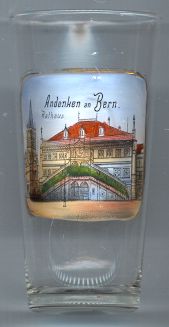
The  Rathaus (town hall) [left] was built in 1406–1416.
It is the oldest secular building in Bern that has retained its original shape. The Rathaus is the seat of the
city council (Stadtrat), the cantonal parliament (Grosser Rat) and the cantonal government.
Rathaus (town hall) [left] was built in 1406–1416.
It is the oldest secular building in Bern that has retained its original shape. The Rathaus is the seat of the
city council (Stadtrat), the cantonal parliament (Grosser Rat) and the cantonal government.
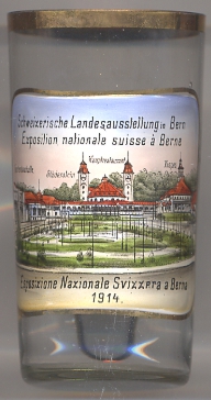
The Schweizerische Landesausstellung (Éxposition nationale suisse, Esposizione Nazionale Svizzera) 1914 in Bern was the third of its kind.
It wasopened on the 15th of May and lasted until the 15th of October. Originally, the exposition had been plannedfor 1913, but had to be postponed due to
delays in he construction of the Lötschberg railway. When World War I broke out the exposition was closed for two weeks. On 1 August the Mobilzation was proclaimed
in Switzerland, but eventually, the Swiss government supported the reopening of the exposition.
The buildings depicted on glass no. 2782 are (from left to right):
Gartenbauhalle
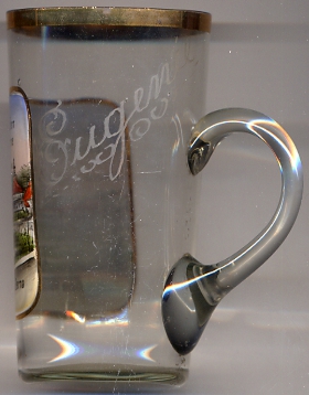
The glass is inscribed (etched) "Eugenie".
[https://de.wikipedia.org/wiki/Schweizerische_Landesausstellung_1914, http://www.derbund.ch/zeitungen/der_kleine_bund/-Vom-Erdboden-verschluckt-/story/13068743]
![[scale]](lineal.jpg)