
|
|
| DEUTSCHLAND | GERMANY |
| Bundesland: Brandenburg | |
| Landkreis: Märkisch-Oderland |
map →
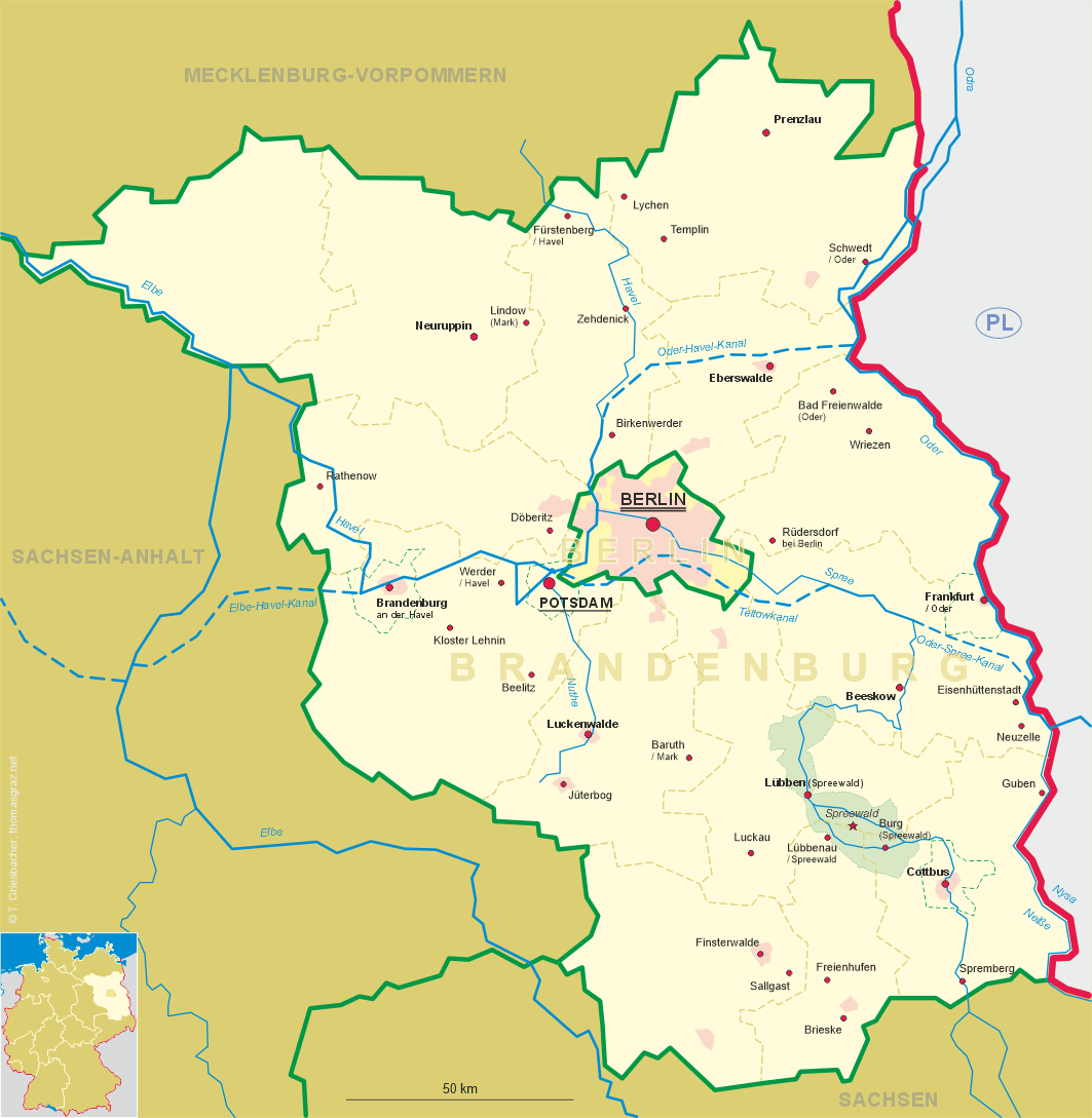
 Rüdersdorf bei Berlin is situated at an elevation of 62 m 30 km east of the city centre of Berlin in the district
Märkisch-Oderland of Germany's state of Brandenburg. The municipality has a population of about 15,100 (2012) and is divided into the four city districts
Rüdersdorf, Hennickendorf, Herzfelde and Lichtenow.
Rüdersdorf bei Berlin is situated at an elevation of 62 m 30 km east of the city centre of Berlin in the district
Märkisch-Oderland of Germany's state of Brandenburg. The municipality has a population of about 15,100 (2012) and is divided into the four city districts
Rüdersdorf, Hennickendorf, Herzfelde and Lichtenow.
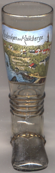
Rüdersdorf originated in 1235–1250, when the Cistercian monastery of Zinna (today part of Jüterbog) founded ten villages within its domains. Already during this time limestone was mined; its first documented use was in the Dominican monastery of Strausberg (1254). The first written document mentioning Roderstorp dates from 1308–1319. During the Reformation introduced by Elector Joachim II of Brandenburg, the monastery of Zinna was secularised and its domains came in possession of the Electorate. A small village for limestone quarry men was founded in 1664, named Alter Kalckgrundt. Another settlement, Neue Berge, followed a few years later. These two settlements became the core of a village that was later known as Kalkberge [see labeling on glass no. 2917]. The municipality Kalkberge was founded in 1931, renamed Rüdersdorf bei Berlin in 1934, consisting of the former Kalkberge, Rüdersdorf and Tasdorf. The neighbouring comunities of Hennickendorf, Herzfelde and Lichtenow were incorporated into Rüdersdorf bei Berlin in 2003.
The  Protestant church in Kalkberge [left, no. 2917: background right],
designed in Gothic revival style after by Friedrich August Stüler, was built in 1869–1873.
Protestant church in Kalkberge [left, no. 2917: background right],
designed in Gothic revival style after by Friedrich August Stüler, was built in 1869–1873.
[https://de.wikipedia.org/wiki/Rüdersdorf_bei_Berlin]
![[scale]](lineal.jpg)