
|
|
| FRANCE | FRANCE |
| région: Grand Est | |
| département: 68, Haut-Rhin |
map →
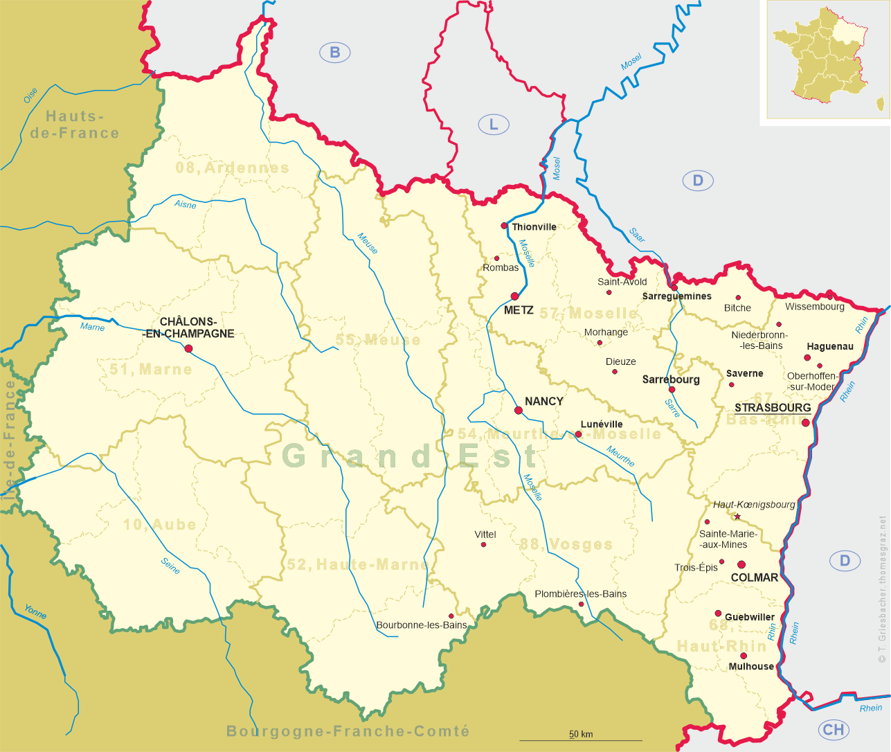
Mulhouse (in German: Mülhausen) is situated at an elevation of 232–338 m on the rivers Doller and Ill in eastern France, close to the Swiss and German borders. With a population of about 110,500 and 278,200 inhabitants in the metropolitan area in 2006, it is the largest city in the département Haut-Rhin, and the second largest in the former région Alsace after Strasbourg. Mulhouse is the principal commune of the 32 making up the Communauté d'agglomération Mulhouse Alsace Agglomération (population 252,000). Mulhouse shares an international airport with Basel, Switzerland, and Freiburg im Breisgau, Germany, which is called EuroAirPort.
 Legends mention the origin of the town in 58 BC, but the first written records of Mulhouse date from the twelfth century. It was part of the southern
Alsatian county of Sundgau in the Holy Roman Empire. From 1354–1515 Mulhouse was part of the Décapole, an alliance of ten towns of the Holy Roman Empire in Alsace
(Haguenau, Colmar, Wissembourg, Turckheim,
Obernai, Kaysersberg, Rosheim, Munster, Sélestat and Mulhouse, later also Seltz and Landau in der Pfalz)
that had been founded in 1354. The city joined the Swiss Confederation as an associate in 1515 and was therefore not annexed by France in the Peace of Westphalia in 1648
like the rest of the Sundgau. An enclave in Alsace, it was a free and independent Calvinist republic, known as Stadtrepublik Mülhausen, associated with the
Swiss Confederation until, after a vote by its citizens on 4 January 1798, it became a part of France in the Treaty of Mulhouse signed on 28 January 1798,
during the Directory period of the French Revolution.
Cotton cloth manufacturing started in the middle of the eighteenth century, and Mulhouse subsequently became one of France’s leading textile centers in the nineteenth century.
The production of machinery and railroad equipment began in 1842.
After the Prussian victory in the Franco–Prussian War (1870) Mulhouse was annexed to the German Empire as part of the territory of Alsace-Lorraine (1870–1918).
Alsace-Lorraine was invaded and annexed by France after World War I. Although never formally restored to Germany after the Battle of France in 1940, it was
occupied by German forces until returned to French control at the end of the war in May 1945. Metz was the capital of the région
Lorraine until 31 December 2015. On 1 January 2016 the regions Alsace, Lorraine and Champagne-Ardenne were merged into the
new région Grand Est (to be renamed on 1 July of that year into Grand Est).
Legends mention the origin of the town in 58 BC, but the first written records of Mulhouse date from the twelfth century. It was part of the southern
Alsatian county of Sundgau in the Holy Roman Empire. From 1354–1515 Mulhouse was part of the Décapole, an alliance of ten towns of the Holy Roman Empire in Alsace
(Haguenau, Colmar, Wissembourg, Turckheim,
Obernai, Kaysersberg, Rosheim, Munster, Sélestat and Mulhouse, later also Seltz and Landau in der Pfalz)
that had been founded in 1354. The city joined the Swiss Confederation as an associate in 1515 and was therefore not annexed by France in the Peace of Westphalia in 1648
like the rest of the Sundgau. An enclave in Alsace, it was a free and independent Calvinist republic, known as Stadtrepublik Mülhausen, associated with the
Swiss Confederation until, after a vote by its citizens on 4 January 1798, it became a part of France in the Treaty of Mulhouse signed on 28 January 1798,
during the Directory period of the French Revolution.
Cotton cloth manufacturing started in the middle of the eighteenth century, and Mulhouse subsequently became one of France’s leading textile centers in the nineteenth century.
The production of machinery and railroad equipment began in 1842.
After the Prussian victory in the Franco–Prussian War (1870) Mulhouse was annexed to the German Empire as part of the territory of Alsace-Lorraine (1870–1918).
Alsace-Lorraine was invaded and annexed by France after World War I. Although never formally restored to Germany after the Battle of France in 1940, it was
occupied by German forces until returned to French control at the end of the war in May 1945. Metz was the capital of the région
Lorraine until 31 December 2015. On 1 January 2016 the regions Alsace, Lorraine and Champagne-Ardenne were merged into the
new région Grand Est (to be renamed on 1 July of that year into Grand Est).
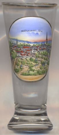
The  church of St. Stepehen (Temple Saint-Étienne) [background right]
goes back to a Romanesque church of the 12th century. At the beginning of the 14th century it was enlarged in
Gothic style, most notably by a substantially higher choir. In 1510, the Romanesque bell tower was remodeled in Renaissance
style. In 1707 the tower was crowned by a Baroque onion dome. In 1857, the city council of Mulhouse decided to replace the
place of worship, which had come to be looked upon as dilapidated, by a new building. The present church was built between
1859 and 1866 in Gothic revival style.
church of St. Stepehen (Temple Saint-Étienne) [background right]
goes back to a Romanesque church of the 12th century. At the beginning of the 14th century it was enlarged in
Gothic style, most notably by a substantially higher choir. In 1510, the Romanesque bell tower was remodeled in Renaissance
style. In 1707 the tower was crowned by a Baroque onion dome. In 1857, the city council of Mulhouse decided to replace the
place of worship, which had come to be looked upon as dilapidated, by a new building. The present church was built between
1859 and 1866 in Gothic revival style.
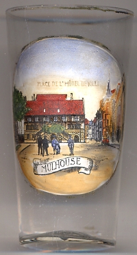 The Hôtel de ville (Town hall) [left] was built in 1553 in the Rhenish Renaissance style. Montaigne described it
as a "palais magnifique et tout doré" ("a splendid golden palace") in 1580. It is known for its trompe l'œil paintings, and its pictures of allegories representing
the vices and virtues.
The Hôtel de ville (Town hall) [left] was built in 1553 in the Rhenish Renaissance style. Montaigne described it
as a "palais magnifique et tout doré" ("a splendid golden palace") in 1580. It is known for its trompe l'œil paintings, and its pictures of allegories representing
the vices and virtues.
The German name of Mulhouse, Mülhausen, should not be confused with
[https://en.wikipedia.org/wiki/Mulhouse, https://en.wikipedia.org/wiki/Décapole;
https://en.wikipedia.org/wiki/Temple_Saint-Étienne]
![[scale]](lineal.jpg)