| DEUTSCHLAND
| GERMANY
|
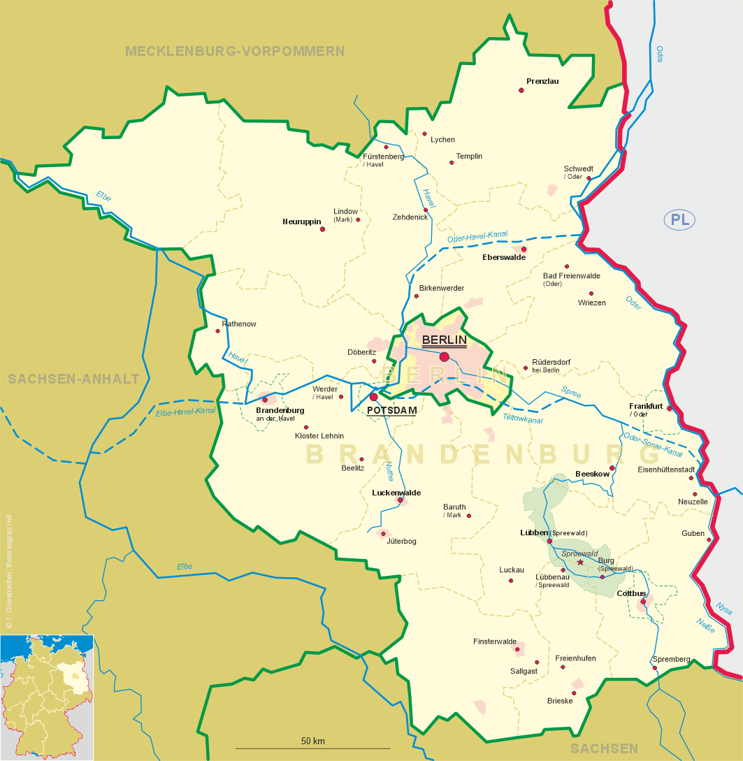
| Bundesland: Brandenburg
|
|
| Landkreis: Oder-Spree
|
|
map →
Eisenhüttenstadt
• prev.: Stalinstadt
• lv: Eizenhitenštate
• lt: Eizenhiutenštatas
• uk: Айзенгюттенштадт
• bg: Айзенхютенщат
• ru: Айзенхюттенштадт
• be: Айзэнгютэнштат
• mk, sr: Ајзенхитенштат
Eisenhüttenstadt is situated at an elevation of 44 m on the western bank of the river Oder in the
district Oder-Spree in the east of Germany's state of Brandenburg. The municipal area stretches on a sandy terrace in
the Berlin–Warsaw glacial valley. It is bounded by the Oder river in the east, which since 1945 forms the
German–Polish border. Eisenh ttenstadt is the eastern terminus of the Oder–Spree Canal. The town
centre is located about 25 km south of Frankfurt (Oder) and 110 km southeast of
Berlin. The municipality has a population of about 24,600 (2018) and comprises the districts
of Diehlo, Fürstenberg (Oder) and Schönfließ.
The present-day township was founded as a socialist model city in 1950 (initially named Stalinstadt after Joseph
Stalin) upon decision of the East German Socialist Unity Party (SED), alongside a new steel mill combine located west of the
historic town of Fürstenberg (Oder). A few years before the new town arose, a bridge over the Oder river had been
constructed, which had been destroyed by retreating Wehrmacht forces in February 1945, near the end of World War II.
The population grew rapidly in the 1950s and 1960s. In 1961, during De-Stalinization, the town was renamed
Eisenhüttenstadt. After the German reunification in 1990, the state-owned steel works were privatized, and most
of its 12,000 employees lost their jobs. The town experienced a steep decline in population, from just over 50,000 to under
30,000. Fürstenberg (Oder) was incorporated into Eisenhüttenstadt in 1961.
Fürstenberg (Oder)
Fürstenberg was founded in the course of the Eastern colonization around 1250 by the Margrave Heinrich 'the Illustrious'
of Meißen from the Wettin dynasty. For centuries, the country town was owned and under the
rule of the Cistercian monastery of Neuzelle. It was first mentioned in a written document dating
from 1286. Today's Nikolaikirche was built in the early 15th century. Industrial development began when Fürstenberg in
1846 received a train station on the Berlin–Breslau (Wrocław)
railway. The Oder–Spree Canal was opened in 1891 and thereafter shipping determined the urban development. The Oder
Bridge was opened in 1919. Around 1939, several armaments factories where relocated here. The necessary workers came from
the Stalag III B prisoner-of-war camp. Between 1940 and 1943, a new inland port was built on the Oder–Spree
Canal. Large-format granite blocks for the planned world capital Germania were stored at the harbor, which were used after the war
for the central Soviet war memorial in Berlin and the construction of Stalinstadt. After the end of the World War II,
the industrial facilities were dismantled as part of war reparations. The Oder bridge was blown up by the German Wehrmacht
in February 1945 and never was rebuilt. Since the end of the war, the Oder forms the border to Poland. In 1961 the town was
incorporated into the municipality of Eisenhüttenstadt.
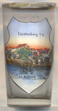
Glass no. 3817 [left] shows a view of  Am Bollwerk at the
bank of the Oder–Spree canal just before the canal joins the river Oder.
Am Bollwerk at the
bank of the Oder–Spree canal just before the canal joins the river Oder.
[https://de.wikipedia.org/wiki/Eisenhüttenstadt, https://en.wikipedia.org/wiki/Eisenhüttenstadt;
https://de.wikipedia.org/wiki/Fürstenberg_(Oder)]
![[scale]](lineal.jpg)
