
|
|
| SCHWEIZ / SUISSE / SVIZZERA / SVIZRA | SWITZERLAND |
| Sankt Gallen / Saint Gall / San Gallo / Son Gagl |
map →
| ru, uk: Таль |
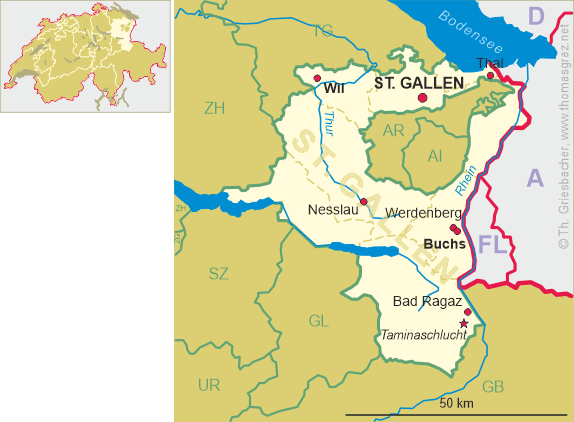
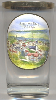 Thal is situated at an elevation of 418 m in a basin about 3 km from the southern shore of Lake Constance and about
15 km northwest of the cantonal capital Sankt Gallen. The municipality has a population of about 6,800 (2021)
and also includes the localities Altenrhein and Staad.
Thal is situated at an elevation of 418 m in a basin about 3 km from the southern shore of Lake Constance and about
15 km northwest of the cantonal capital Sankt Gallen. The municipality has a population of about 6,800 (2021)
and also includes the localities Altenrhein and Staad.
Curtis tale was first mentioned in a written document dating from 1163. Weinburg castle was of regional importance as the seat of various noble
families (1419–1686), of federal importance as a county recorder's office (1686–1772) and of European importance as a seat of the
Princes of Hohenzollern-Sigmaringen (1817–1929). Due to financial problems, the castle in
1929 was sold to the Steyler Mission Society (Societas Verbi Divini, SVD) and one year later opened under the new name Gymnasium Marienburg, first as
a mission school. The secondary school was followed by a theological seminary and finally a heigh school. However, the school closed in 2012.
Staad railway station and Altenrhein airport are also located in the municipality.
[https://de.wikipedia.org/wiki/Thal_SG, https://en.wikipedia.org/wiki/Thal,_St._Gallen]
![[scale]](lineal.jpg)