
|
|
| ČESKÁ REPUBLIKA | CZECH REPUBLIC |
| Ústecký kraj | Ústí nad Labem region |
| Okres: Litoměřice |
map →
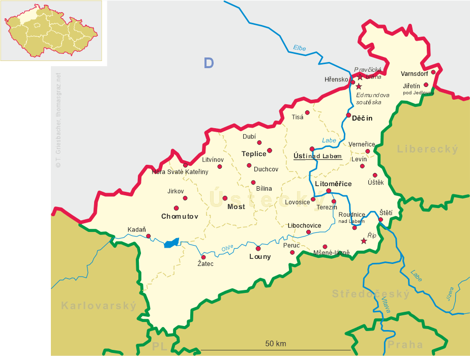
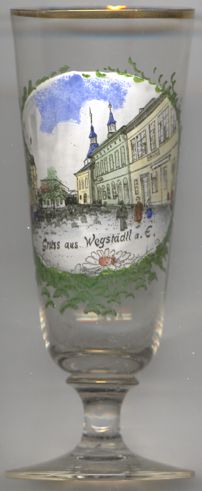 Štětí (former German name: Wegstädtl) is situated at an elevation of 155 m on the right bank of the river Labe (Elbe),
about 20 km southeast of the district town Litoměřice and about 33 km southeast of the regional capital,
Ústí nad Labem. The municipality has a population of about 8,600 (2023).
Štětí (former German name: Wegstädtl) is situated at an elevation of 155 m on the right bank of the river Labe (Elbe),
about 20 km southeast of the district town Litoměřice and about 33 km southeast of the regional capital,
Ústí nad Labem. The municipality has a population of about 8,600 (2023).
The first written mention of Štětí dates from 1312. For centuries, it was part of the Mělník estate, owned
first by Bohemian queens and later by various noble families. In 1549 it obtained the privileges of a town. During the Thirty Years' War (1618–1648), the town
was looted several times. In 1654, Štětí was still ethnically Czech, but in the following decades, German settlers came to the town, which gradually
became predominantly ethnically German. During the 18th century, the town was hit by various disasters: the passage of troops, floods, epidemics, crop failures and
a large fire in 1788. The economic boom occurred in the 19th century. In addition to agriculture and river fishing, Štětí was famous for the
production of stockings. In 1850 the section Prague–Lovosice of the Austrian Northern Railroad (completed in 1851
further on to Ústí nad Labem and Děčín) opened and as one station was built on the opposite bank of the Labe
in Hněvice this was a major reason for the industrialisation of Štětí. After World War I, Štětí became part of
Czechoslovakia. After World War II, the German-speaking population was dispossessed and expelled.
[https://de.wikipedia.org/wiki/%C5%A0t%C4%9Bt%C3%AD, https://en.wikipedia.org/wiki/%C5%A0t%C4%9Bt%C3%AD;
https://de.wikipedia.org/wiki/Bahnstrecke_Praha%E2%80%93D%C4%9B%C4%8D%C3%ADn]
![[scale]](lineal.jpg)