
|
|
| ÖSTERREICH | AUSTRIA |
| Bundesland: Steiermark | Styria |
| Bezirk: Bruck-Mürzzuschlag |
map →

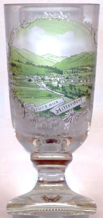
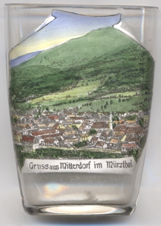
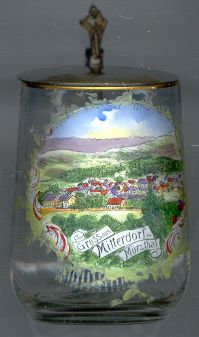 Mitterdorf im Mürztal is situated at an elevation of 587 m in the valley of the river Mürz. The village (former municipality)
has a population of about 2,400 (2021) and since 2015 is part of the new municipality Sankt Barbara im Mürztal.
Mitterdorf im Mürztal is situated at an elevation of 587 m in the valley of the river Mürz. The village (former municipality)
has a population of about 2,400 (2021) and since 2015 is part of the new municipality Sankt Barbara im Mürztal.
The oldest known document that mentions Mitterendorf dates from 1139. A noble seat was mentioned in 1363. This was replaced after 1555 by a new castle (Schloss Pichl). The castle was the birthplace of Johann Ritter von Kalchberg (1765–1827) who was an important Austrian playwright of his time and also was well-known for his work as a historian. The castle is used today as a school for forestry. On 1 January 2015, the formerly independent municipalities of Mitterdorf im Mürztal, Veitsch and Wartberg im Mürztal were merged to become the new municipality of Sankt Barbara im Mürztal.
 The
The  former filial church Sankt Johannes Nepomuk [near left, no. 4054: centre right]
today is used as a public library. A modern church, dedicated to St. Barbara, was built nearby in 1986.
former filial church Sankt Johannes Nepomuk [near left, no. 4054: centre right]
today is used as a public library. A modern church, dedicated to St. Barbara, was built nearby in 1986.
[https://de.wikipedia.org/wiki/Mitterdorf_im_M%C3%BCrztal;
https://de.wikipedia.org/wiki/Liste_der_denkmalgesch%C3%BCtzten_Objekte_in_Sankt_Barbara_im_M%C3%BCrztal;
https://de.wikipedia.org/wiki/Johann_Ritter_von_Kalchberg;
https://www.katholische-kirche-steiermark.at/goto/instvisitenkarte/1145/Pfarre_Wartberg_im_M__rztale]
![[scale]](lineal.jpg) contact: webmaster
contact: webmaster