
|
|
| ČESKÁ REPUBLIKA | CZECH REPUBLIC |
| Olomoucký kraj | Olomouc region |
| Okres: Šumperk |
map →
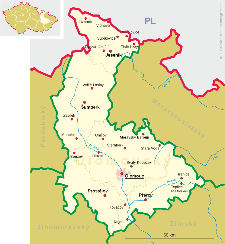
 Branná (German: Goldenstein) is situated at an elevation 633 m on the irght bank of the stream Branná
on the edge of the Hrubý Jeseník mountains, about 20 km north-northwest of the district town
Šumperk and about 65 km north-northeast of the regional capital,
Olomouc. As of 1 January 2023, the municipality had a population of 633.
Branná (German: Goldenstein) is situated at an elevation 633 m on the irght bank of the stream Branná
on the edge of the Hrubý Jeseník mountains, about 20 km north-northwest of the district town
Šumperk and about 65 km north-northeast of the regional capital,
Olomouc. As of 1 January 2023, the municipality had a population of 633.
The settlement was founded around 1282. The village, situated on an old trade route to Silesia, was first mentioned in writing in 1301. In 3125 it was granted the status of a free mining town and in 1570 it obtained the privileges of a market town. Following the abolition of the patrimonial lordships, Goldenstein/Koldštýn, together with the hamlets of Aloisdorf/Aloisov, Messinghammer/Mosazné Hamry and Grund/Grunt, formed a municipal district in the district of Mährisch-Schönberg (Šumperk) from 1850 onwards. In 1921 the Czech name Koldštýn changed to Kolštejn. Under the Munich Agreement, the town was ceded to the German Reich in 1938 and, until 1945, formed part of the district of Mährisch-Schönberg, in the administrative region of Troppau (Opava), within the Reichsgau Sudetenland (see map). After the end of the World War II, the majority of the German inhabitants were expelled. In 1946, the municipality of Kolštejn was renamed Branná.
The  Church of St. Michael the Archangel [left, no. 0000: background centre]
was built in the early 17th century, consecrated in 1614, then as the Evangelical Church of the Resurrection of Christ.
In 1743, the church was remodeled as a Catholic church by the extension of a bell tower and a new façade; on that occasion its
dedication was changed to the current one. Further repairs took place after the fire in 1852 and in 1907.
Church of St. Michael the Archangel [left, no. 0000: background centre]
was built in the early 17th century, consecrated in 1614, then as the Evangelical Church of the Resurrection of Christ.
In 1743, the church was remodeled as a Catholic church by the extension of a bell tower and a new façade; on that occasion its
dedication was changed to the current one. Further repairs took place after the fire in 1852 and in 1907.
[https://de.wikipedia.org/wiki/Brann%C3%A1;
https://cs.wikipedia.org/wiki/Kostel_svat%C3%A9ho_Michaela_archand%C4%9Bla_(Brann%C3%A1)]
![[scale]](lineal.jpg)