
|
|
| ČESKÁ REPUBLIKA | CZECH REPUBLIC |
| Karlovarský kraj | Karlovy Vary region |
| Okres: Karlovy Vary |
map →
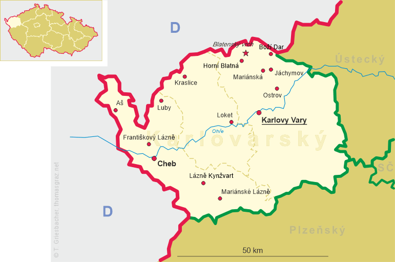
 Ostrov (German: Schlackenwerth) is situated at an elevation of 398 m at the confluence of the
Jachymovský potok (Weseritz) and the river Bystřice (Wistritz) in the Karlovy Vary district
of western Bohemia.
Ostrov (German: Schlackenwerth) is situated at an elevation of 398 m at the confluence of the
Jachymovský potok (Weseritz) and the river Bystřice (Wistritz) in the Karlovy Vary district
of western Bohemia.
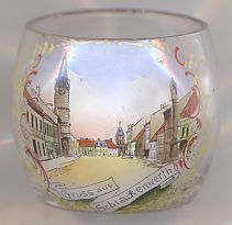
The earliest document conatining written mention of the town probably dates to 1207. An inventory of 1226 mentions the town as a possession of the Hrabischitz family. Located on an important trading route from Prague to Cheb, Ostrov thrived on the tolls that were collected. After the Battle of the White Mountain (today part of Prague, 1620), the town came in possession of the duchy of Saxe-Lauenburg. In 1691 Ostrov was obtained by the margraviate of Baden, after Margrave Ludwig Wilhelm of Baden-Baden in 1690 had married Princess Franziska Sibylla Augusta of Saxe-Lauenburg. The couple built the famous 'White Castle' as their residence. In 1709, the margravine ordered the construction of the votive chapel, designed on the model of the pilgrimage chapel of Einsiedeln in Switzerland, when her son, the later Margrave Ludwig Georg Simpert, finally had started to speek at the age of six years. Another copy of the chapel was built in Rastatt, which Margrave Ludwig Wilhelm of Baden-Baden had chosen as his new residence town in 1705. Today the town has a population of about 17,200 (2005). Its twin city is Rastatt.
The picture on glass no. 2223 shows a view of the
 market
Ostrov, in the Czech language literally meaning 'island', is a very common place name in Czechia. In this collection,
another glass shows a view from Ostrov, part of the municipality Zápy in Central Bohemia.
![[scale]](lineal.jpg)