
|
|
| DEUTSCHLAND | GERMANY |
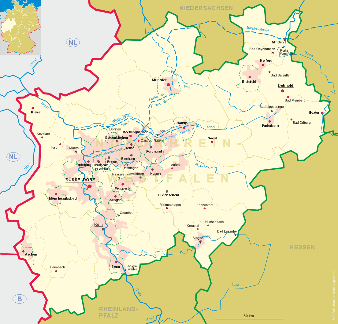
| Bundesland: Nordrhein-Westfalen | North Rhine-Westphalia |
| Regierungsbezirk: Münster | |
| Stadt: Münster |
map →
Münster is situated at an elevation of 60 m at the river Münstersche Aa, about 15 km south of its confluence with the river Ems, in the Westphalian Lowland. Münster is an independent city (kreisfreie Stadt) and capital of the administrative region (Regierungsbezirk) of the same name. The municipality has a population of about 291,800 (2011).
In 793, Charlemagne sent out Ludger as a missionary to evangelise the area which today is known as the Münsterland. In 797, Ludger founded a school that later became
the Cathedral School. He was ordained as the first bishop of Münster. The first cathedral was completed by 850. The combination of ford and crossroad, market place,
episcopal administrative centre, library and school, established Münster as an important centre. In the Middle Ages Münster was a leading member of the Hanseatic League.
In 1534, the Anabaptists led by Jan van Leiden, took power in the Münster Rebellion and founded a democratic proto-socialistic state. They claimed all property, burned
all books except the Bible, and called it the "New Jerusalem". However, the town was recaptured in 1535; the Anabaptists were tortured to death, their corpses were
exhibited in cages, which can still be seen hanging on the Tower of St. Lambert's steeple. Part of the signing of the Peace of Westphalia of 1648, which ended the
Thirt Years' War (1618–1648) was held in Münster (the other part of the signing took place in Osnabrück). In 1802, during the Napoleonic Wars, Münster was conquered
 by Prussia and became the capital of the Prussian province of Westphalia. A century later in 1899 the city's harbour started operations when the city was linked to the
Dortmund-Ems Canal. A secondary target of the Oil Campaign of World War II, Münster was bombed on 25 October 1944 during a mission to a nearby primary target, the
Scholven/Buer synthetic oil plant at Gelsenkirchen. About 91% of the Old City and 63% of the entire city was destroyed by Allied air raids. In the 1950s the Old City was
rebuilt to match its pre-war state, though many of the surrounding buildings were replaced with cheaper modern structures.
by Prussia and became the capital of the Prussian province of Westphalia. A century later in 1899 the city's harbour started operations when the city was linked to the
Dortmund-Ems Canal. A secondary target of the Oil Campaign of World War II, Münster was bombed on 25 October 1944 during a mission to a nearby primary target, the
Scholven/Buer synthetic oil plant at Gelsenkirchen. About 91% of the Old City and 63% of the entire city was destroyed by Allied air raids. In the 1950s the Old City was
rebuilt to match its pre-war state, though many of the surrounding buildings were replaced with cheaper modern structures.
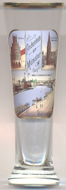
The historic  Town Hall [left, no. 2731: top left] was one of the theatres of the negotiations of the Peace of Westphalia which concluded
the Thirty Years' War in Europe and the Eighty Years' War between Spain and the Republic of the Seven United Netherlands. It was the site of the Peace of Münster of 1648.
Located in the centre of Prinzipalmarkt, it one the city's predominant landmarks. The oldest town hall was built in 1170 but was replaced in 1200 by a new building.
In 1320 the front part of the town hall was added which in turn was enlarged by a porch around 1395. Further additions and alterations were made in 1576/1577, 1602, 1773/1776,
1861 and 1892. Before its destruction in 1944, important parts of the interior decorations were removed and could be reused in the restoration of the historic town
hall that took place in 1950–1958.
Town Hall [left, no. 2731: top left] was one of the theatres of the negotiations of the Peace of Westphalia which concluded
the Thirty Years' War in Europe and the Eighty Years' War between Spain and the Republic of the Seven United Netherlands. It was the site of the Peace of Münster of 1648.
Located in the centre of Prinzipalmarkt, it one the city's predominant landmarks. The oldest town hall was built in 1170 but was replaced in 1200 by a new building.
In 1320 the front part of the town hall was added which in turn was enlarged by a porch around 1395. Further additions and alterations were made in 1576/1577, 1602, 1773/1776,
1861 and 1892. Before its destruction in 1944, important parts of the interior decorations were removed and could be reused in the restoration of the historic town
hall that took place in 1950–1958.
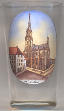
The Lambertikirche (church of St. Lambert) [right, no. 3113, and left, no. 2731: top right] was founded by merchants to counterbalance the
overpowering cathedral of Münster. The oldest church at the market square was already founded around 1000. The present church was built from 1735 onwards
as a hall church in Westphalian late Gothic style. The church also became famous for the fact that the bodies of the leaders of the Anabaptists,
Jan van Leiden, Bernd Krechting and Bernd Knipperdolling, who had been tortured and executed in 1535, had been exhibited in cages that were hung on the tower of the church.
The original church tower began to lean over towards the late 19th century. Because of the danger of its collapsing, it was replaced by a new tall spire in Neogothic style
in 1888/1889. The tower has a height of 90.5 metres. The iron cages for the Anabaptists' bodies were again placed on the southern side of the new spire.
The church suffered severe damages in 1944 but was restored according to the historic Neogothic appearance until 1956. Only the sacristy was rebuilt after a modern design.
The bottom picture on glass no. 2731 shows the
harbour
Another glass in this collection shows views of Munster in Lower Saxony (note the difference in spelling:
[https://de.wikipedia.org/wiki/Münster_(Westfalen), http://en.wikipedia.org/wiki/Münster;
http://en.wikipedia.org/wiki/Historical_City_Hall_of_Münster, https://de.wikipedia.org/wiki/Historisches_Rathaus_Münster;
https://de.wikipedia.org/wiki/St._Lamberti_(Münster);
http://en.wikipedia.org/wiki/Dortmund–Ems_Canal]
![[scale]](lineal.jpg)