
|
|
| ÖSTERREICH | AUSTRIA |
| Bundesland: Niederösterreich | Lower Austria |
| Bezirk: Tulln |
map →

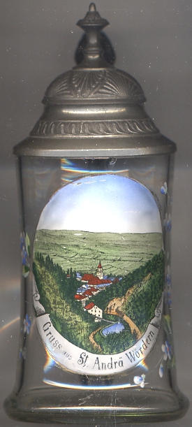 Sankt Andrä-Wördern is situated at an elevation of 177 m at the southeastern end of the Tullnerfeld plain in the foothills of the Wienerwald (Vienna Forest) mountains,
about 11 km east of the district town, Tulln. The municipality of Sankt Andrä-Wördern has a population of about 7,600 (2013).
Sankt Andrä-Wördern is situated at an elevation of 177 m at the southeastern end of the Tullnerfeld plain in the foothills of the Wienerwald (Vienna Forest) mountains,
about 11 km east of the district town, Tulln. The municipality of Sankt Andrä-Wördern has a population of about 7,600 (2013).
Sankt Andrä was first mentioned in 1140 in a deed of donation to the monastery of Klosterneuburg.
From 1185 until 1803 it was a possession of the bishopric of Passau.
In 1972 the communities of St. Andrä vor dem Hagentale, Wördern, Greifenstein, Hintersdorf and Kirchbach
were merged into the new municipality of St. Andrä-Wördern.
[https://de.wikipedia.org/wiki/Sankt_Andrä-Wördern]
The  church Sankt Andreas is the Catholic parish church of St. Andrä vor dem Hagentale [centre].
The parish was founded around 1090 by bishop Altmann of Passau. It became the seat of a chorepiscope and was the mother parish of
Langenlebarn, Tulbing, Königstetten, Zeiselmauer and Mauerbach. Parts of the church date back to the
Romnesque period. The three-aisled nave in Gothic style dates from the 14th century. The church tower and the chapel of St. Thomas also date from the Gothic
period. The church was severely damaged in 1683 during the Ottoman invasions, but was repaired thereafter with Baroque additions.
church Sankt Andreas is the Catholic parish church of St. Andrä vor dem Hagentale [centre].
The parish was founded around 1090 by bishop Altmann of Passau. It became the seat of a chorepiscope and was the mother parish of
Langenlebarn, Tulbing, Königstetten, Zeiselmauer and Mauerbach. Parts of the church date back to the
Romnesque period. The three-aisled nave in Gothic style dates from the 14th century. The church tower and the chapel of St. Thomas also date from the Gothic
period. The church was severely damaged in 1683 during the Ottoman invasions, but was repaired thereafter with Baroque additions.
[https://de.wikipedia.org/wiki/Pfarrkirche_St._Andrä_vor_dem_Hagental]
![[scale]](lineal.jpg)