
|
|
| ČESKÁ REPUBLIKA | CZECH REPUBLIC |
| Středočeský kraj | Central Bohemia region |
| Okres: Nymburk |
map →
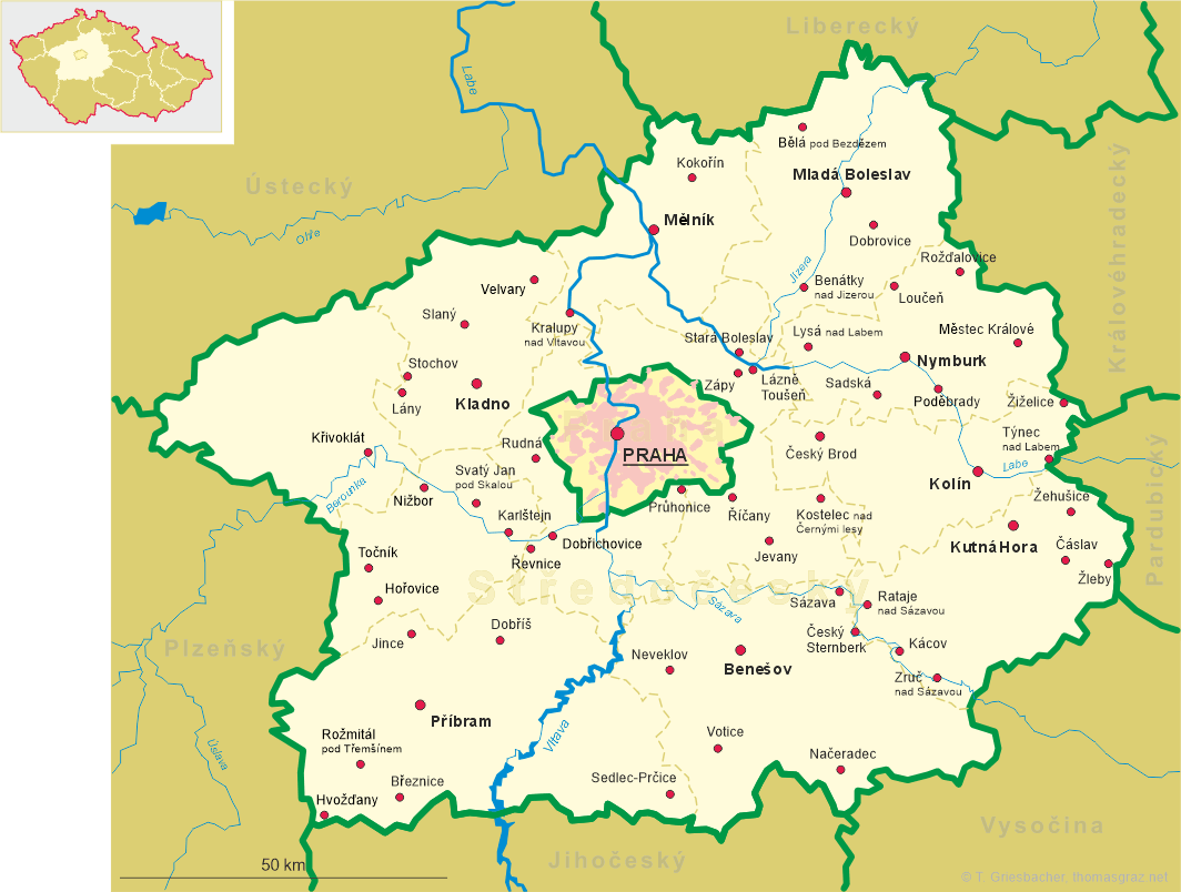
 Městec Králové
is situated at an elevation of 212 m in the Nymburk district of Central Bohemia. The municipality, consisting of
Městec Králové, Nový and Vinice, has a population of about 2,900 (2014).
Městec Králové
is situated at an elevation of 212 m in the Nymburk district of Central Bohemia. The municipality, consisting of
Městec Králové, Nový and Vinice, has a population of about 2,900 (2014).
According to tradition, it is believed that Městec Králové is the birthplace (ca.1233) of Přemysl Otakar I, King of
Bohemia 1198–1230. Under the rule of the Přemyslides, the place of their castle was called Königsfeld. The fortified village
was founded in the 13th century at the trading route from Hradec Králové to Prague.
Under Karl IV (King of Bohemia 1347, Emperor 1355) the village was chartered as a town and was given to Karl's wife, Anna princess of Schweidnitz
(Świdnica) and Jauer (Jawor). After 1373 ownership of the town changed several times. The town was destroyed by a large fire in 1610, again during
the Thirty Years' War (1618–1648), and again by large fires in 1680, 1746 and 1776.
[https://de.wikipedia.org/wiki/Městec_Králové]
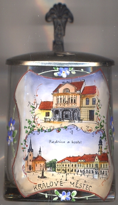
The  parish church of St. Margaret [bottom picture: left]
was built in 1856 in Romanesque revival style after a fire had destroyed the previous church.
parish church of St. Margaret [bottom picture: left]
was built in 1856 in Romanesque revival style after a fire had destroyed the previous church.
[https://cs.wikipedia.org/wiki/Městec_Králové]
The town hall [bottom picture: right]
was rebuilt in 1792 after a fire had destroyed the old town hall.
The building was modified several times and gained its current appearance in 1907 with Art Nouveau elements and a turret.
[http://svk7.svkkl.cz/arl-kl/cs/detail-kl_us_auth-0264102-Radnice-Mestec-Kralove-cesko/]
![[scale]](lineal.jpg)