
|
|
| DEUTSCHLAND | GERMANY |
| Bundesland: Freistaat Sachsen | Saxony |
| Landkreis: Erzgebirgskreis |
map →

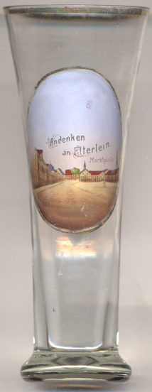 Elterlein is situated at an elevation of 620 m in the Erzgebirge (Ore Mountains) district of soutwestern Saxony,
about 10 km west of the district town Annaberg-Buchholz. The municipality has a population of
about 2,900 (2018).
Elterlein is situated at an elevation of 620 m in the Erzgebirge (Ore Mountains) district of soutwestern Saxony,
about 10 km west of the district town Annaberg-Buchholz. The municipality has a population of
about 2,900 (2018).
Elterlein began to develop located on the salt-trading route from Halle to Prague
that was important in the Middle Ages. The oldest document referring to das Elterlein ('the small altar') at this
locations dates from 1406. The oldest mention of a town of this name dates from 1483. During the period of the so-called
Second (or Great) 'Berggeschrey', a silver rush in the late 15th century, it soon gained importance as a mining place.
Mining gave rise to processing industries such as mills, hammer and smelting works already at an early stage. The town was
destroyed several times by large fires in 1662, 1676, 1719, 1861 and 1868. Mining activities decreased and finally were
abandoned in the mid-19th century. The neighbouring community of Schwarzbach, first mentioned in 1240, was incorporated
into the municipality of Elterlein in 1996, Hermannsdorf, first mentioned around 1460, followed in 1999.
[https://de.wikipedia.org/wiki/Elterlein]
![[scale]](lineal.jpg)