
|
|
| ÖSTERREICH | AUSTRIA |
| Bundesland: Steiermark | Styria |
| Bezirk: Hartberg-Fürstenfeld |
map →

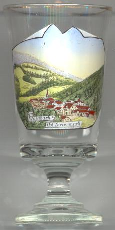 Waldbach is situated at an elevation of 623 m in the upper Lafnitz valley, about 21 km northwest of the district town
Hartberg and about 51 km northeast of Graz, the capital of Austria's federal state of Styria.
The former municipality has a population of 621 (2023) and since 2015 is part of the municipality of Waldbach-Mönichwald.
Waldbach is situated at an elevation of 623 m in the upper Lafnitz valley, about 21 km northwest of the district town
Hartberg and about 51 km northeast of Graz, the capital of Austria's federal state of Styria.
The former municipality has a population of 621 (2023) and since 2015 is part of the municipality of Waldbach-Mönichwald.
Waldpach was first mentioned in a written document dating from 1250. In 2015 it was merged with the neighbouring municipality of Mönichwald into the new combined municipality of Waldbach-Mönichwald.
The  parish church Sankt Georg [left, no. 536: background left] was first mentioned in 1464.
The Gothic church was rebuilt and enlarged in Baroque style in 1688 and 1701, and subsequently obtained the status of a parish church. The church
was renovated in 1961–1963.
parish church Sankt Georg [left, no. 536: background left] was first mentioned in 1464.
The Gothic church was rebuilt and enlarged in Baroque style in 1688 and 1701, and subsequently obtained the status of a parish church. The church
was renovated in 1961–1963.
[https://de.wikipedia.org/wiki/Waldbach_(Steiermark);
https://www.waldbach-moenichwald.gv.at/artikel/chronik-ortsteil-waldbach;
https://de.wikipedia.org/wiki/Pfarrkirche_Waldbach]
![[scale]](lineal.jpg)