
|
|
| ÖSTERREICH | AUSTRIA |
| Bundesland: Steiermark | Styria |
| Bezirk: Hartberg-Fürstenfeld |
map →

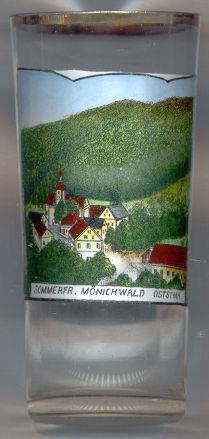
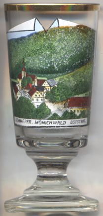 Mönichwald is situated at an elevation of 600 m at the river Lafnitz at the southern slope of the Hochwechsel (1,738 m) mountain,
about 20 km northwest of the district town Hartberg and about 53 km northeast of Graz, the capital
of Austria's federal state of Styria. The former municipality has a population of about 785 (2023). Since 2015 is part of the municipality of
Waldbach-Mönichwald.
Mönichwald is situated at an elevation of 600 m at the river Lafnitz at the southern slope of the Hochwechsel (1,738 m) mountain,
about 20 km northwest of the district town Hartberg and about 53 km northeast of Graz, the capital
of Austria's federal state of Styria. The former municipality has a population of about 785 (2023). Since 2015 is part of the municipality of
Waldbach-Mönichwald.
Munichwalt was first mentioned in a document dating from 1163. Monks from the Benedictine abbey of Formbach (Vornbach, today part of Neuhaus a. Inn) in Bavaria had cleared the woods and built the first chapel, hence the name Mönichwald ('monk in the woods'). In 2015, Mönichwald and the neighbouring municipality of Waldbach were merged into the new municipality of Waldbach-Mönichwald.
The  parish church Sankt Peter und Paul [left] goes back to a church consecrated in 1163. The present
Baroque church was built in 1716.
parish church Sankt Peter und Paul [left] goes back to a church consecrated in 1163. The present
Baroque church was built in 1716.
[https://de.wikipedia.org/wiki/M%C3%B6nichwald;
https://de.wikipedia.org/wiki/Pfarrkirche_M%C3%B6nichwald]
![[scale]](lineal.jpg)