
|
|
| UNITED STATES OF AMERICA | |
| COLORADO | |
| Denver County |
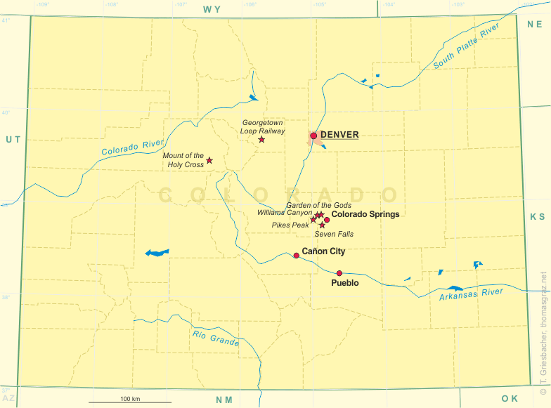
map →
 Denver, the capital of Colorado, has been founded by a party of prospectors on November 17, 1858, after a gold discovery at the confluence of
Cherry Creek and the South Platte River. The town was named for James W. Denver, Governor of Kansas Territory, of which eastern Colorado was then a part.
Other gold discoveries sparked a mass migration of some 100,000 in 1859-60, leading the federal government to establish Colorado Territory in 1861.
The gold rush also caused the rude dispossession of the Cheyenne and Arapaho Indians. By 1890 Denver had become the second most populous city in the West, second only to San Francisco.
After the Depression of 1893 the civic leaders began promoting economic diversity and Denver became known as „cow town“ of the Rockies. Many oil companies established their regional or national
headquarters in Denver which caused a further growth of the city after World War II and during the 1970's. Due to its proximity to the Rocky Mountains, skiing and tourism
has become a further factor in Denver's economy. When railroads and later airlines began to bypass Denver, the city opened a new $5 billion airport in 1995, the largest US airport in terms of area (55 square miles).
Situated at an elevation of 5,280 ft or 1 mile (1,609 m), Denver is called the „Mile High City“.
Denver, the capital of Colorado, has been founded by a party of prospectors on November 17, 1858, after a gold discovery at the confluence of
Cherry Creek and the South Platte River. The town was named for James W. Denver, Governor of Kansas Territory, of which eastern Colorado was then a part.
Other gold discoveries sparked a mass migration of some 100,000 in 1859-60, leading the federal government to establish Colorado Territory in 1861.
The gold rush also caused the rude dispossession of the Cheyenne and Arapaho Indians. By 1890 Denver had become the second most populous city in the West, second only to San Francisco.
After the Depression of 1893 the civic leaders began promoting economic diversity and Denver became known as „cow town“ of the Rockies. Many oil companies established their regional or national
headquarters in Denver which caused a further growth of the city after World War II and during the 1970's. Due to its proximity to the Rocky Mountains, skiing and tourism
has become a further factor in Denver's economy. When railroads and later airlines began to bypass Denver, the city opened a new $5 billion airport in 1995, the largest US airport in terms of area (55 square miles).
Situated at an elevation of 5,280 ft or 1 mile (1,609 m), Denver is called the „Mile High City“.
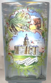
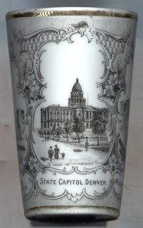
The  Colorado State Capitol Building [left no. 913: bottom] was built from
1868 to 1907 in Italian Renaissance Revival style according to a design by Elija E. Meyers. The central circular drum tower is capped
with a gold gilded dome and cupola standing 276 ft (84 m) high. Denver was made the official capitol city on
December 9, 1867, when Colorado was still a territory. Colorado became the 38th state of the United States on August 1, 1876.
Colorado State Capitol Building [left no. 913: bottom] was built from
1868 to 1907 in Italian Renaissance Revival style according to a design by Elija E. Meyers. The central circular drum tower is capped
with a gold gilded dome and cupola standing 276 ft (84 m) high. Denver was made the official capitol city on
December 9, 1867, when Colorado was still a territory. Colorado became the 38th state of the United States on August 1, 1876.
[Other Capitol buildings depicted on items of this collection are the United States Capitol in Washington, DC, the Massachusetts State Capitol and the Old State House in Boston, MA, the Indiana Statehouse in Indianapolis, IN, and the New York State Capitol in Albany, NY.]
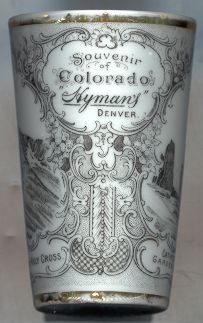
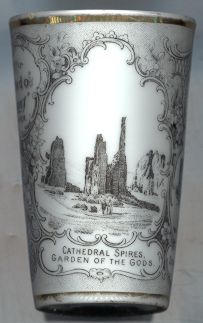
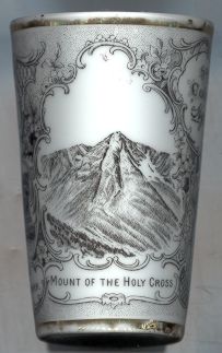
One of the three pictures on tumbler no. B031 also shows the Denver State Capitol Building. The other two pictures on show the Cathedral Spires in Garden of the Gods and Mount of the Holy Cross.
| Clear Creek County |
The Georgetown Loop Railway was built as an extension of the railroad from Denver which reached Georgetown in 1877.
Although the distance between Georgetown and Silver Plume is only 2 miles (3.2 km), the elevation difference is over 600 ft (180 m).
The narrow-gauge rail line was constructed by Union Pacific engineer Robert Blickensderfer. The line was completed in 1884 and twisted and turned, looping back
over itself, over four and a half miles of track to gain the elevation.
The Devil's Gate Viaduct [top left],
300 feet (91 m) long and almost 100 feet (30 m) high, formed a spiral where the track actually crossed over itself and became a popular turn of the century tourist attraction.
In 1939, the track and bridges were dismantled and sold for scrap. Between 1975 and 1984, the railroad and Devil's Gate viaduct were rebuilt under the direction of the Colorado Historical Society.
| El Paso County |
The top right picture on glass no. 913 shows Balanced Rock, one of the most photographed rock formations of
![[scale]](lineal.jpg)