
|
|
| ČESKÁ REPUBLIKA | CZECH REPUBLIC |
| Plzeňský kraj | Plzeň region |
| Okres: Tachov |
map →
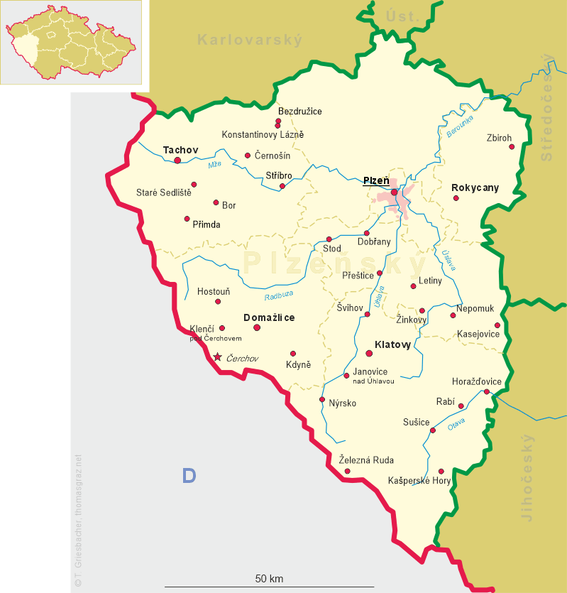
 Staré Sedliště is situated at an elevation of 512 m in the Tachov district of the Plzeňský region in Western Bohemia.
The municipality covers an area of 37.38 square kilometres, and has a population of about 1,100 (2006).
Staré Sedliště lies approximately 9 km south-east of Tachov, 49 km west of Plzeň,
and 129 km west of Prague.
Staré Sedliště is situated at an elevation of 512 m in the Tachov district of the Plzeňský region in Western Bohemia.
The municipality covers an area of 37.38 square kilometres, and has a population of about 1,100 (2006).
Staré Sedliště lies approximately 9 km south-east of Tachov, 49 km west of Plzeň,
and 129 km west of Prague.
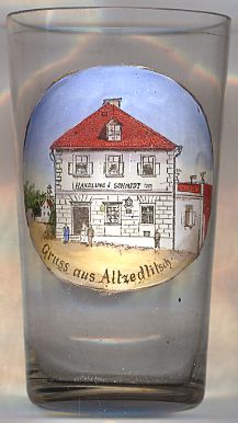
The oldest known document which mentions Zedlissie dates from 1177, the earliest reference to Antiqua Sedlisczt dates from 1429. The earliest reference to its status as oppidum (market town) is found in the church chronicles of Tachov of 1572. In 1622 Markt Altensetlisch obtained the privilege of having an own seal. Large parts of the town were destroyed by the large fires of 1790 and 1839. The town was connected to the railroad system in 1910 when the railway line from Planá u Mariánských Lázní (Plan) to Domažlice (Taus) was opened. In 1946 the German-speaking inhabitants were expelled.
The building depicted on glass no. 2539 is labeled
[Text adapted from http://en.wikipedia.org/wiki/Staré_Sedliště, https://de.wikipedia.org/wiki/Staré_Sedliště]
 Handlung
![[scale]](lineal.jpg) contact: webmaster
contact: webmaster