
|
|
| ČESKÁ REPUBLIKA | CZECH REPUBLIC |
| Středočeský kraj | Central Bohemia region |
| Okres: Benešov |
map →
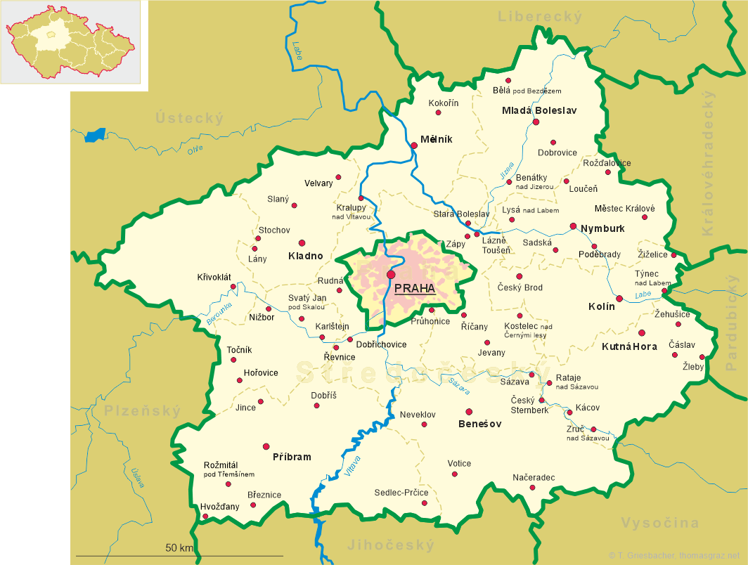
 Benešov is situated at an elevation of 360 m about 40 km southeast of Prague
in the Central Bohemian region. Benešov is the capital of the district (okres) of the same name. The municipality
has a population of about 16,900 (2023). The municipality comprises the settlements Baba, Bedrč, Benešov, Boušice,
Buková Lhota, Červený Dvůr, Dlouhé Pole, Chvojen, Konopiště,
Mariánovice, Okrouhlice, Pomněnice, Radíkovice, Úročnice and Vidlákova Lhota.
Benešov is situated at an elevation of 360 m about 40 km southeast of Prague
in the Central Bohemian region. Benešov is the capital of the district (okres) of the same name. The municipality
has a population of about 16,900 (2023). The municipality comprises the settlements Baba, Bedrč, Benešov, Boušice,
Buková Lhota, Červený Dvůr, Dlouhé Pole, Chvojen, Konopiště,
Mariánovice, Okrouhlice, Pomněnice, Radíkovice, Úročnice and Vidlákova Lhota.
The first settlers are believed to have arrived on Karlov Hill in 1050 during the Přemyslid dynasty. The first written mention of Benissaw, however, dates only from 1226. A small monastery was founded here in 1246. By 1300 they left and the property was sold to the Lord of Sternberg (Šternberk), whose crest is still the city's coat of arms. In 1420 the then mostly German populated city was conquered and burned by the Hussites. In the 15th and 16th centuries the town experienced an economic boom, especially thanks to its location on the trade route from Prague to Linz. In 1871 the town was connected to Prague by rail and by 1895 it was an important regional hub. By World War I, Benesov was an important garrison town of the Austro-Hungarian Monarchy. Early during World War II the town was evacuated temporarily as the 'SS-Truppenübungsplatz Böhmen' of the Waffen-SS was stationed here. A significant measure of industrialisation began after 1945 with the establishment of a machinery factory and the food industry.
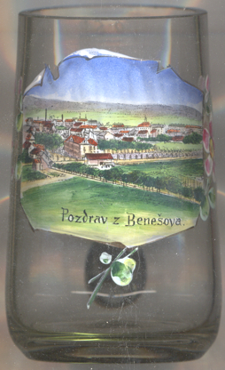
The picture on glass no. 4602 [near left] shows a view of
 Masarykovo
The Neo-Renaissance building depicted on the right is the
old
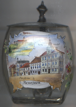
The picture on glass no. 4956 [near left] shows a street view of Tyršova street. The building depicted
in the background right (behind the trees) is the
Piarist College
[https://de.wikipedia.org/wiki/Benešov, https://de.wikipedia.org/wiki/Benešov;
https://cs.wikipedia.org/wiki/Okresn%C3%AD_soud_v_Bene%C5%A1ov%C4%9B]
![[scale]](lineal.jpg)