
|
|
| DEUTSCHLAND | GERMANY |
| Bundesland: Freistaat Bayern | Bavaria |
| Regierungsbezirk: Oberfranken | |
| Landkreis: Wunsiedel im Fichtelgebirge |
map →

 Selb is situated at an elevation of 562 m in the northeast of Bavaria, at the border to the Czech Republic
(with the neighbouring Czech town Aš). The municipality has a populaton of about
14,900 (2019).
Selb is situated at an elevation of 562 m in the northeast of Bavaria, at the border to the Czech Republic
(with the neighbouring Czech town Aš). The municipality has a populaton of about
14,900 (2019).
The lords de Selewen were first mentioned in 1135, the village was first mentioned in 1281 when Selb togather with Aš were pledged to the bailiffs of Plauen. In 1412 it was purchased by the burgraves of Nuremberg who in 1437 made Selb one of the six district towns in the margraviate of Brandenburg-Bayreuth. In 1426 Selb obtained the status of a town. Until well into the 18th century, Selb was known as a centre of mining and iron-working. Following the Treaty of Schönbrunn (Vienna) (1809), Selb in 1810 became part of the Kingdom of Bavaria. In 1836 it again was given the status of a town. Most parts of the medieval town were destroyed by a large fire in 1856. In 1857 the Hutschenreuther porcellain factory was founded. Due to the novel industrial process, porcellain for the first time became affordable for ordinary people. When the railroad from Hof to Eger (today Cheb) opened in 1864, many more factories were founded and already in 1900 there were 20 of them. Until today, Selb is known as a centre of porcellain-making. In 1919 Selb became independent from the district Rehau, in 1972 it was incorporated into the district Wunsiedel.
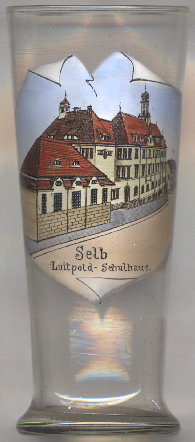
The picture on glass no. 3934 [left] shows a vire of the
[https://de.wikipedia.org/wiki/Selb;
https://issuu.com/stefanstroessenreuther/docs/selb_umland]
<
 Luitpold school (today Primary School Selb III), which was opened in 1908.
![[scale]](lineal.jpg) contact: webmaster
contact: webmaster