
|
|
| ČESKÁ REPUBLIKA | CZECH REPUBLIC |
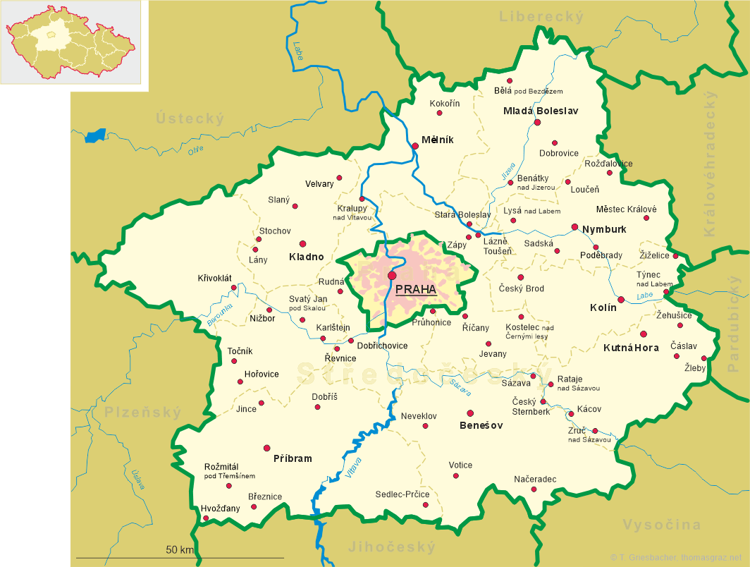
| Středočeský kraj | Central Bohemia region |
| Okres: Benešov |
map →
 Votice is situated at an elevation of 483 m in the north of the Středočeská pahorkatina (Central Bohemian Highlands) region,
about 16 km southwest of the district town Benešov in the Central Bohemia region. The municipality has a population
of about 4,500 (2021).
Votice is situated at an elevation of 483 m in the north of the Středočeská pahorkatina (Central Bohemian Highlands) region,
about 16 km southwest of the district town Benešov in the Central Bohemia region. The municipality has a population
of about 4,500 (2021).
Archaeological finds make it probable that Votice was founded in the mid 12th century. The oldest known written document that mentions Otice dates from 1359. In the course of the 14th century it developed into a market town. The name Otice gradually changed to the modern name Votice in the mid 16th century. After the end of manorialism, Votice in 1848 became a municipality and was placed in the district Seltschan (Sedlčany). In 1850 it became the seat of a separate district, but already in 1868 the administration was moved back to Seltschan. In subsequent years, Votice frequently was described as a town although it had not officially received this status. In the course of the construction of the Emperor Franz Josef Railroad (Vienna – Gmünd – Budweis (České Budějovice) – Pilsen (Plzeň) – Eger (Cheb)) in 1867–1872, Votice got its own railroad station. During the Nazi period, the Jewish community of Votice, which had existed since the 15th century, was deported to the extermination camps of Theresienstadt (Terezín) and Maly Trostenec (Малы Трасцянец, Maly Trascjanec, BY). After World War II, Votice again became theseat of the administration of a district; however, the district Votice was incorporated into the district Benešov in in 1961.
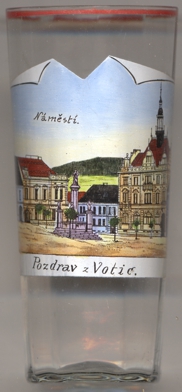
The  Marian column in the market square (Komenského náměstí) [left, no. 4272:
foreground centre] was created in 1750. The statue of Our Lady was added in 1877.
Marian column in the market square (Komenského náměstí) [left, no. 4272:
foreground centre] was created in 1750. The statue of Our Lady was added in 1877.
[https://de.wikipedia.org/wiki/Votice]
![[scale]](lineal.jpg)