
|
|
| MAGYARORSZÁG | HUNGARY |
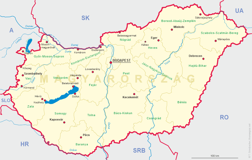
| megye: Borsod-Abaúj-Szemplén |
map →
Sátoraljaújhely is situated at an elevation of 190 m at the northern end of the Hungarian part of the Tokaj winegrowing region, directly at the border to Slovakia, about 80 northeast of the capital of the Borsod-Abaúj-Szemplén county, Miskolc. The municipality of Sátoraljaújhely has a population of about 15,600 (2011).
 The origins of the town go back to the times of the Conquest of Hungary. Sátor-alja literally means
'under the tent', referring to the tent-shaped hill nearby. The town was rebuilt in the 13th century after the Tatars
had destroyed the old settlement. The new town thereafter was named újhely, 'new town'. In 1261
Sátoraljaújhely obtained the privileges of a town and in 1748 it became the centre of the Zemplén
county. Sátoraljaújhely has always been an important town in culture. Ferenc Kazinczy, one of the reformers of the
Hungarian language, lived here in the 18th century. In 1808, rabbi Moses Teitelbaum founded an important Hasidic jewish
commmunity, which in 1905 counted 4,500 members.
After the Revolution of 1848, Sátoraljaújhely developed rapidly owing to its location close to
important trade routes leading to Poland, Russia, and Transylvania. Under the Treaty of Trianon (1920), Hungary lost its
northern territories; the border was set at the Ronyva stream, splitting the city into two parts. One-fifth of the
population and one-fourth of the territory of the town became part of Czechoslovakia. The newly created village got the
name of Slovenské Nové Mesto ("Slovak new town") in Slovak; Szlovákújhely
("Slovak new town") or Kisújhely ("Little new town") in Hungarian. The ceded territory also included the
industrial zone and two railway lines. The town's industry was being rebuilt during the interwar period, but the outbreak
of World War II disrupted this development. Nazi repression, continuous bombing after 1943, the killing of most of
its Jewish population (most were forcibly sent to Auschwitz) and finally the Soviet occupation left the town in a very
poor condition. During the reorganisation of administration in 1950, the former comitatus of Zemplén became part
of the united Borsod-Abaúj-Zemplén county, and Sátoraljaújhely lost its county capital status.
Sátoraljaújhely was rebuilt again and is today a national ski centre and tourism destination.
The origins of the town go back to the times of the Conquest of Hungary. Sátor-alja literally means
'under the tent', referring to the tent-shaped hill nearby. The town was rebuilt in the 13th century after the Tatars
had destroyed the old settlement. The new town thereafter was named újhely, 'new town'. In 1261
Sátoraljaújhely obtained the privileges of a town and in 1748 it became the centre of the Zemplén
county. Sátoraljaújhely has always been an important town in culture. Ferenc Kazinczy, one of the reformers of the
Hungarian language, lived here in the 18th century. In 1808, rabbi Moses Teitelbaum founded an important Hasidic jewish
commmunity, which in 1905 counted 4,500 members.
After the Revolution of 1848, Sátoraljaújhely developed rapidly owing to its location close to
important trade routes leading to Poland, Russia, and Transylvania. Under the Treaty of Trianon (1920), Hungary lost its
northern territories; the border was set at the Ronyva stream, splitting the city into two parts. One-fifth of the
population and one-fourth of the territory of the town became part of Czechoslovakia. The newly created village got the
name of Slovenské Nové Mesto ("Slovak new town") in Slovak; Szlovákújhely
("Slovak new town") or Kisújhely ("Little new town") in Hungarian. The ceded territory also included the
industrial zone and two railway lines. The town's industry was being rebuilt during the interwar period, but the outbreak
of World War II disrupted this development. Nazi repression, continuous bombing after 1943, the killing of most of
its Jewish population (most were forcibly sent to Auschwitz) and finally the Soviet occupation left the town in a very
poor condition. During the reorganisation of administration in 1950, the former comitatus of Zemplén became part
of the united Borsod-Abaúj-Zemplén county, and Sátoraljaújhely lost its county capital status.
Sátoraljaújhely was rebuilt again and is today a national ski centre and tourism destination.
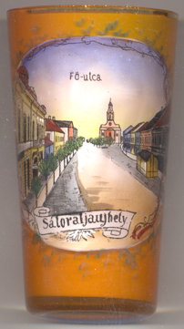
The Catholic  church of St. Stephen (Szent István király templom
[background] dates from the late Baroque period and was remodeled in the late 19th century according
to plans of architect Győző Czigler.
church of St. Stephen (Szent István király templom
[background] dates from the late Baroque period and was remodeled in the late 19th century according
to plans of architect Győző Czigler.
The picture on glass no. 3369 is labeled Fő-utca (Main Street). Today, this street is named Kossuth Lajos tér (Lajos Kossuth Square) in honor of the Governor-President of the Kingdom of Hungary during the revolution of 1848/49.
Further places called Neustadt (or similar), of which glasses are in this collection, are:
[https://de.wikipedia.org/wiki/Sátoraljaújhely, https://en.wikipedia.org/wiki/Sátoraljaújhely,
https://hu.wikipedia.org/wiki/Sátoraljaújhely;
https://hu.wikipedia.org/wiki/Czigler_Győző, https://en.wikipedia.org/wiki/Lajos_Kossuth]
in Austria:
in the Czech Republic:
in Germany:
in Poland:
in Romania:
![[scale]](lineal.jpg) contact: webmaster
contact: webmaster